taksim for all // superspace
Text description provided by the architects.
taksim for all : the grid that commons the city
———————————————————–
an old square that has forgotten how to be one, traumatized long before with unintentional wrongdoings; an old park haunted by a ghost of a long-gone barrack, once its trees had the courage standing for their rights. are they going to help each other heal, holding into a grid behaving as a regenerative terraphy? ———————————————————- Taksim district has had numerous interferences, through the years by the needs and desires of the community and space.
© superspace
every revision in recent years shivered the integrity of the physical space. especially the last move that took almost all the motorized circulation under the ground, although a positive development, erased all the borders, history, and memory of the space. the main problems of the space are the lack of orientation in the vastness, the disconnections on the human scale, and the missing memories and history of the place.
© superspace
the park and the square have not always been in their perfect mood and affected accordingly to their beloved users, it is not easy to deal with people. Taksim gets its name from the function of “sharing and distribution” of water when the “Maksem” was in use. as it was the center of dealing with water then, now it is dealing with people, which has similar mechanisms like the water finding its way through grooves and pipes but you have to supply the necessary structures, otherwise, it would be wasted.
© superspace
such a waste of space, if it is not socially shared, where everybody feels home and reclaims the space for various events and even lazy days, increasing permeability with significant elements for comfortable access and attracting people to sustain the place.
the city dwells along the strands of Bosphorus, accompanying interesting sightseeings from Marmara to the Black sea.
© superspace
The project area oversees the Bosphorus from hidden locations and even though it is 80m above sea level and the city has various centers, Taksim square is the symbolic heart of the city which seeks more attention than any other place.
the geography of the city, which is unique in its fluctuant topography and straddled lands along the Bosphorus makes it difficult to forget once visited.
© superspace
It is one of the most interesting places on earth, along with the most challenging problems. as the historical capital made it out of the city walls, it would not stop despite the obstacles and transform sinuously into a mega-city of fifteen million residents in its metropolitan area. urban and green infrastructure is not sufficient for this kind of density.
© superspace
the poly-centric structure of the city also reflects upon the social structure and many places do not accommodate substructures with a basis for urban platforms.how do we reveal the potential of the area and make them healthy public spaces again without being disruptive and hurtful to their nature? What can we do to revitalize the square into a social urban space?Istanbul is a very dynamic city, even on the outskirts and so is its social life, day and night.
© superspace
there are various squares and parks scattered along with the city but very few have both. parks and squares are the dynamic networks and connecting nodes of lively cities and communities.
when they possess inadequate infrastructure or not at all, they become unattractive and turn into waste, and even repulsive spaces in no time that no one wants to be around, they are as good as dead.
© superspace
the main reason for these places being interpreted as dead is that they have little or too much permeability, lack the social realm, and human scale that gives no positive contribution to their surroundings. multi-use of urban voids can improve safety and mobility, strengthen communities, enhance sustainability, and contribute to the local economy by placemaking tools.
how can we use the potential of the existing park and embed new functions into its iconic and historical context? how can we foster and support the community through art and design?
‘Taksim republic monument’ had been placed in a very particular space in 1928, which had a centric position and formed a physical square in a roundabout and axial connections with the surroundings, that also changed within time, and became an island in an ocean with the latest pedestrianization revision that implemented in 2013.
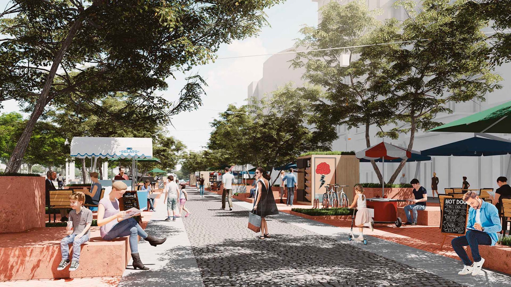
proposal offering the ‘re-creating Cumhuriyet street’ which is a very important part of the ‘Istanbul trade axis’ by using the lines of the past, blending with the new connections to scaling both the monument and Taksim square.
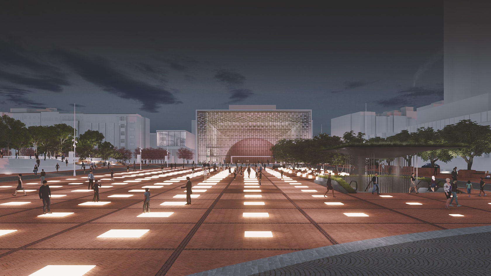
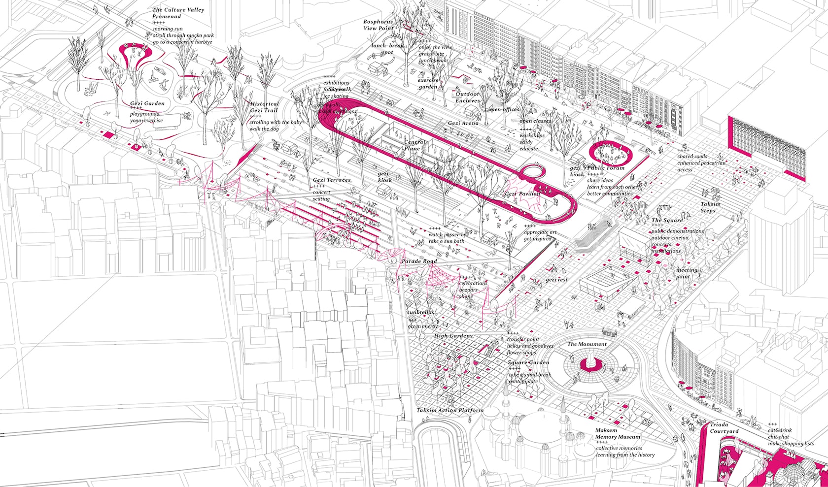
welcoming everyone for any kind of interaction spaces around the territory, from the park to promenade, square to the skywalk, that is triggering and activating urban continuum with regular spaces in connection to surrounding history.
the actual land use of the site is formed by h.prost, after the demolishment of the ‘Taksim artillery barracks’ for the sake of transforming an obsolete building into a public space, for Taksim square plan and a continuous green infrastructure for the city.
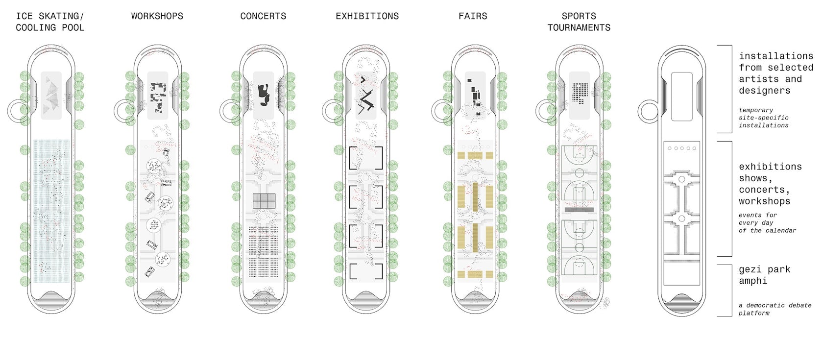
named as ‘Gezi park’, offering a loop trail surrounded by strict tree rows on the exterior, and more monumental hardcovered piazza inside, which considered the issues of re-arranging the logic of the original space use of the historical Gezi park plan, in the first phase. “Taksim for all” sustains programmable and flexible spaces for triggering public use, besides re-generating the urban void.
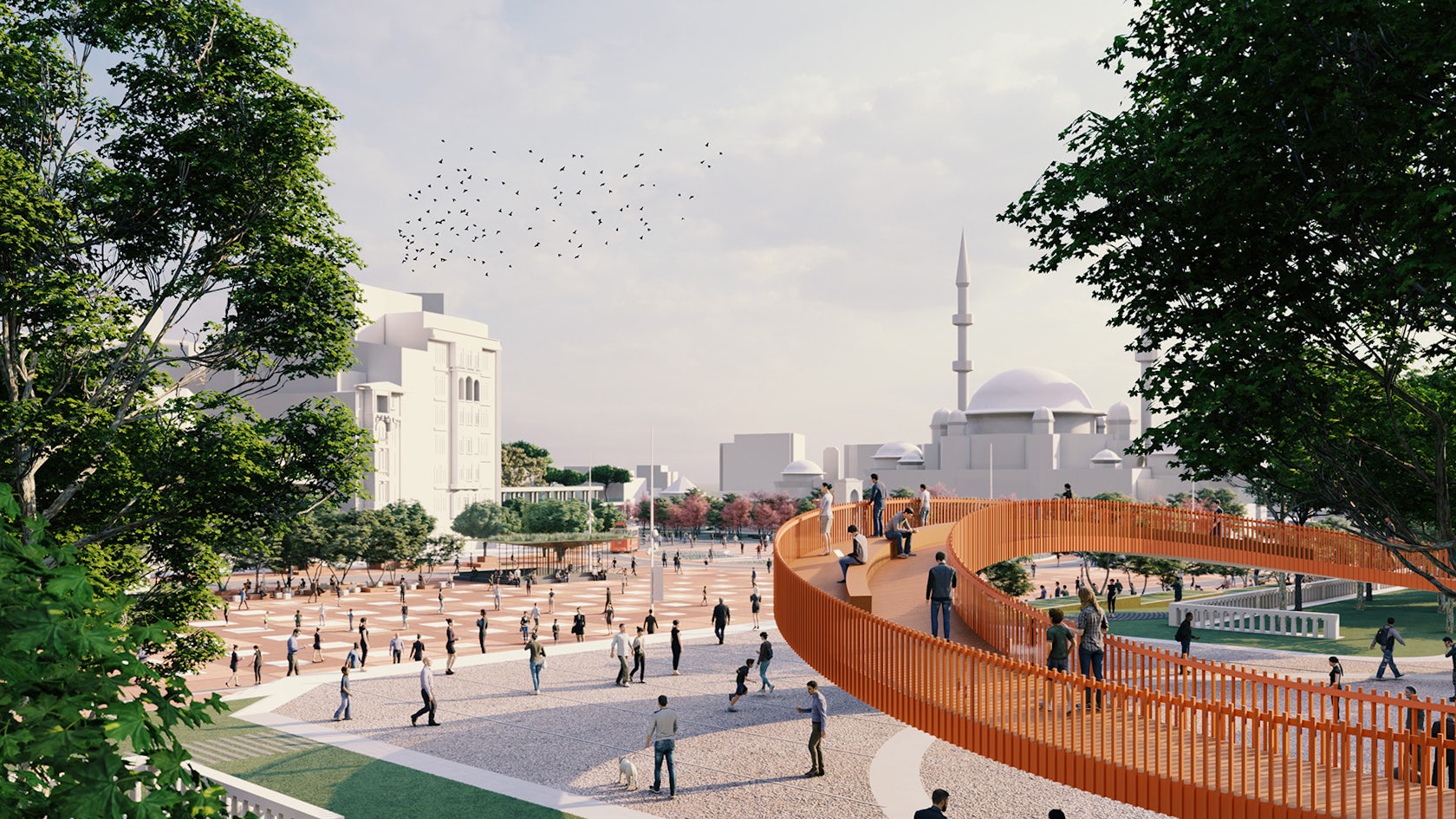
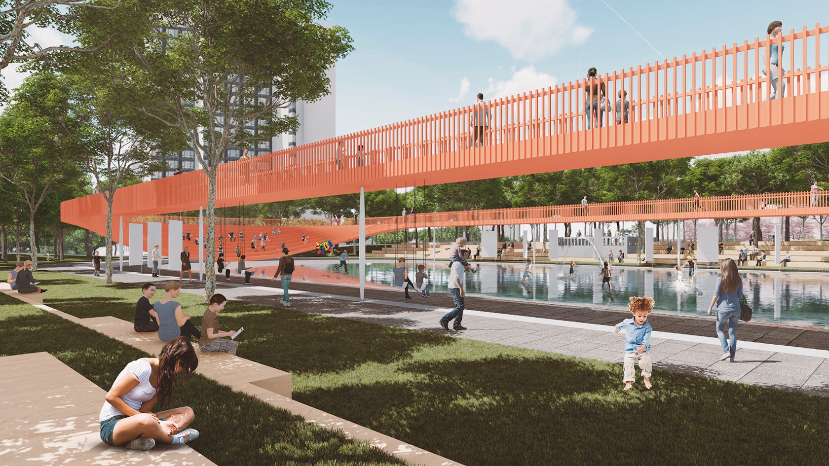
‘Taksim square’ with a natural podium from park direction can be used for bigger events outside daily use, and ‘Gezi courtyard’ would be the new heart of Taksim, which surrounded a new pedestrian trail ‘Gezi skywalk’ encouraging people to visit various functions and events, from sports to concerts, festivals to exhibitions, during all seasons of the year.
the park would be a new social and cultural hub for the city.Gezi park simplifies to its original plan while enriched with daily use spaces, which suffers to get enough traffic these days. the skywalk offers a new elevated trail for the park tracing the historical lines, promoting multifunctional use inside, including fairs, art installations, concerts, and bazaars in the core of the park.the existing traces of the area are not visible anymore.
there are not any trails but wide roads inside Gezi park, which makes it more like walking in an urban area but not a park, with very little greenery but huge nice trees. the monument floats at the entrance of Istiklal.
Cumhuriyet street is a 40m wide pedestrian street with only one row of trees and it gets 100m as it connects to the monument and Taksim square which makes them all lose context.
the existing traces of the area collided and harmonized with the used to be but not implemented thoroughly historical lines, existing urban texture complementary lines, and temporary future irregular lines which especially makes the Gezi park a memoir of history, now and future with a holistic approach to the site in general and connecting the monument, the square, and the park as if they have had always been.
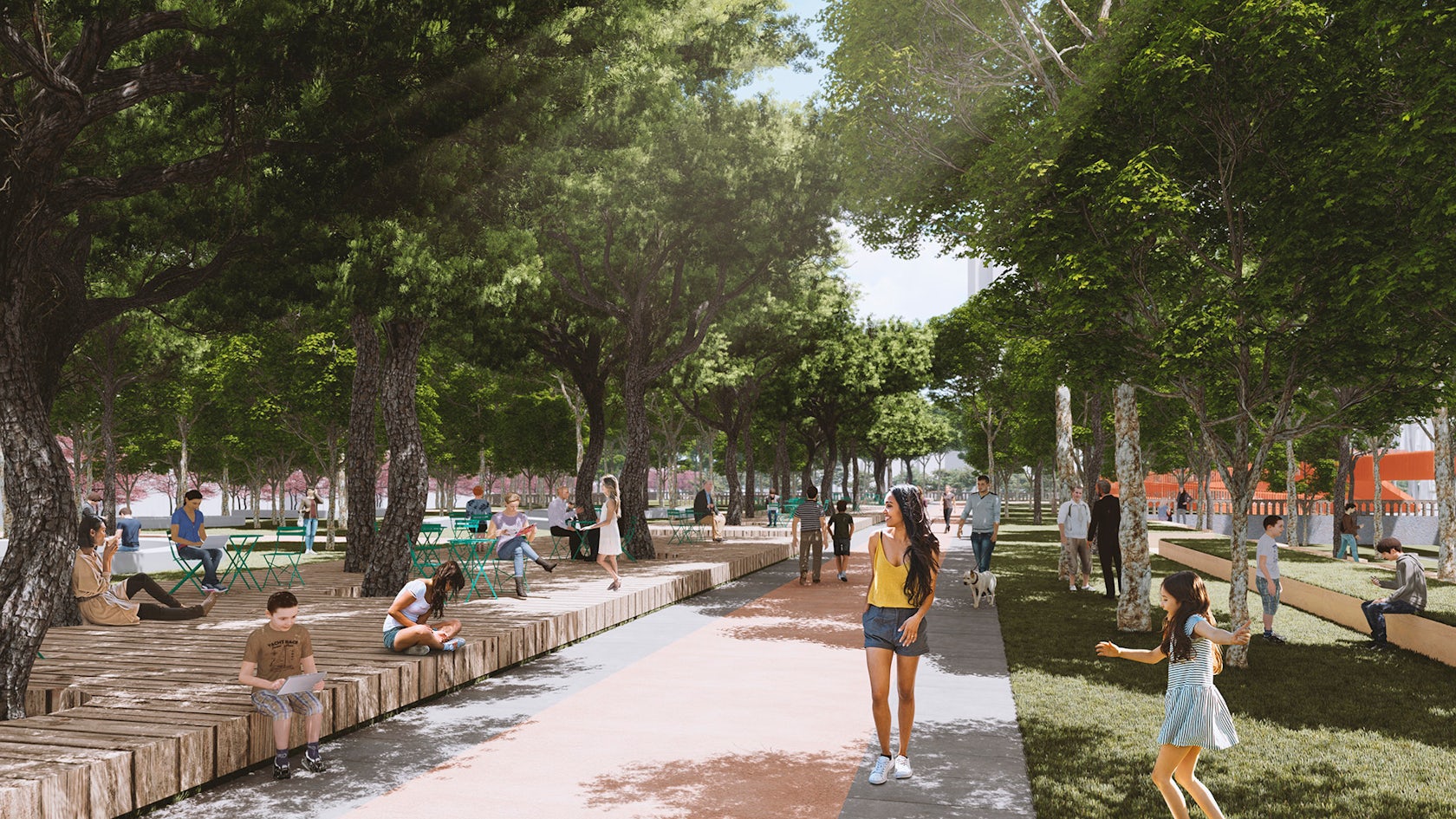
remaining of the park is left to the chance of a wilder nature, led by irregular sinuous paths inside.
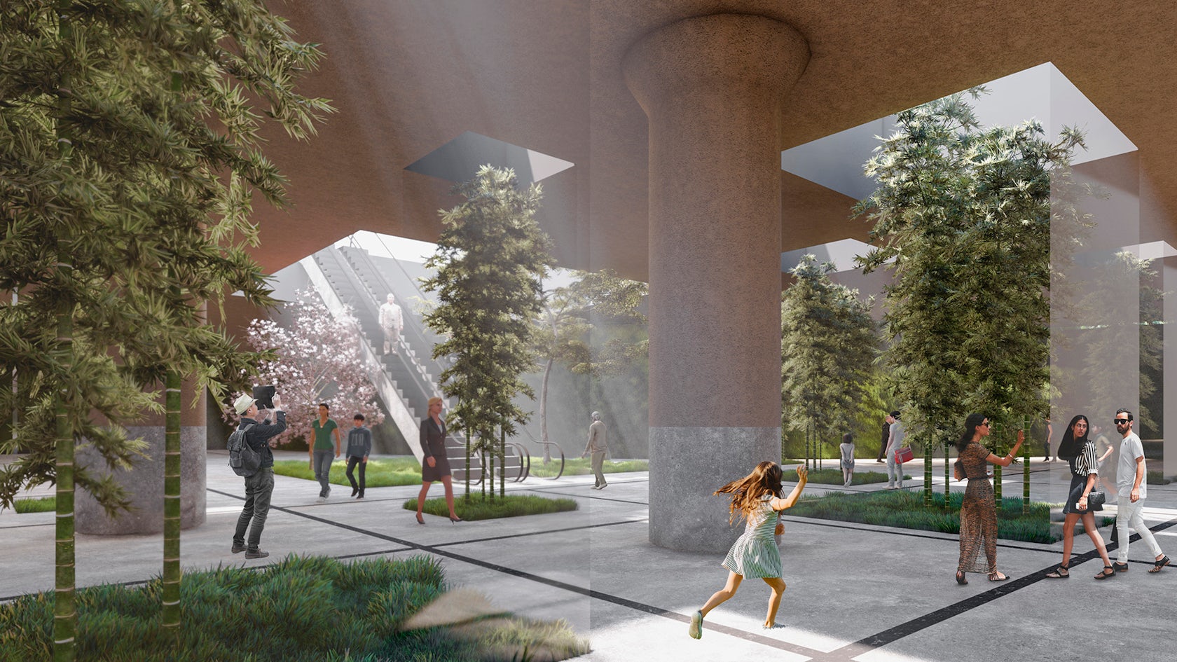
underground terminal converted into a sunken garden, switches to a brighter open space that strengthens the connection with the ground. .
